Category: affection

  • Urban heat: a thermal camera study in Budapest

    Urban heat: a thermal camera study in Budapest

    In 2023, a comprehensive thermal camera study was conducted in Budapest to analyze how various urban elements contribute to the city’s heat. Using a Flir One camera attached to a mobile phone, we captured detailed thermal images to identify significant sources of urban heat and potential cooling solutions. This blog post presents key findings from this study, highlighting the significant sources of urban heat and potential solutions for cooling our city.

    The heat impact of air conditioning units
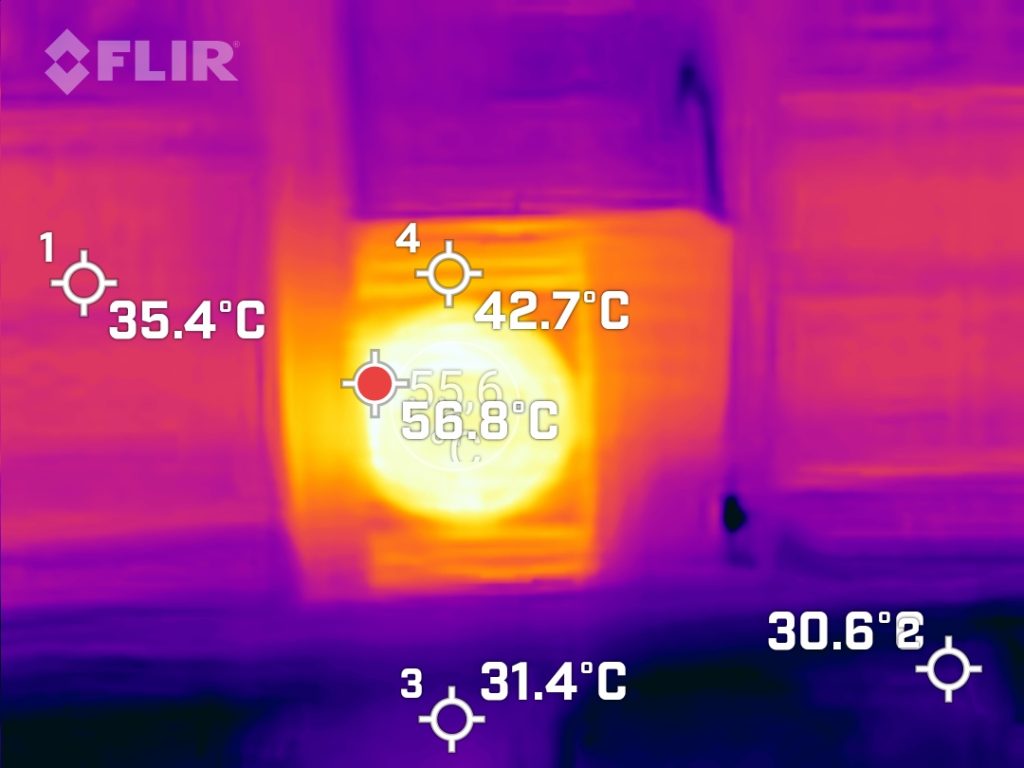
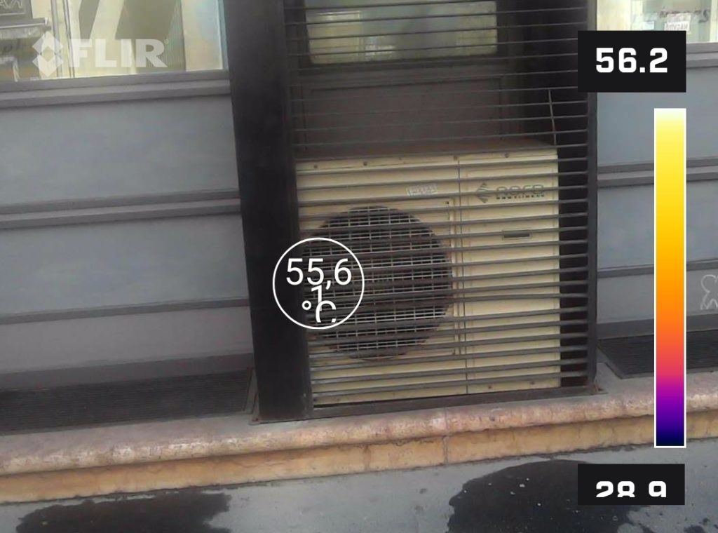
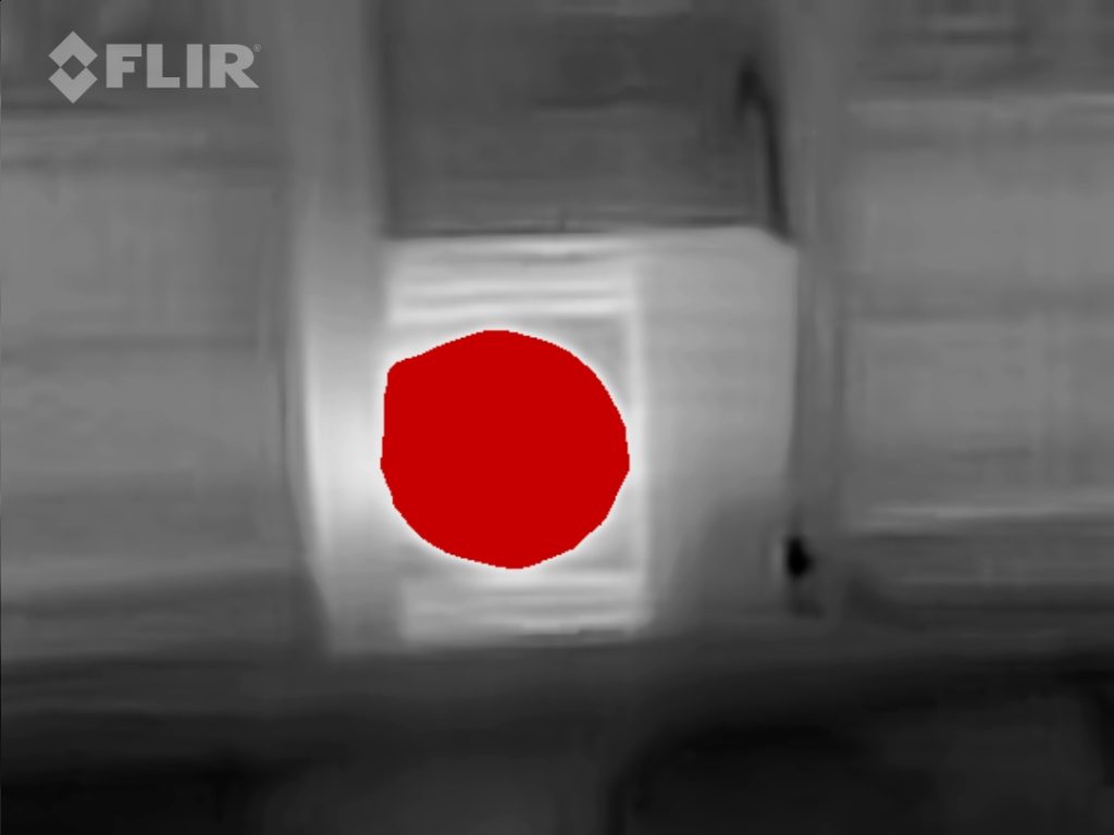
    In the heart of Budapest, in Erzsébet- and Terézváros, it’s really hot in the summer. The thermal images show that the outdoor units of spot air conditioners on the street-facing sides of buildings are releasing a lot of heat into the urban environment.

    The thermal camera measurements show that the air conditioning unit is a source of heat, with temperatures reaching up to 56.8°C. The surrounding areas are cooler, but still have elevated temperatures of 35.4°C and 42.7°C, which are significantly higher than the ambient air temperature. This shows that the heat given off by the unit affects the area around it and contributes to the wider urban heat island effect.

    If these units are placed at street level, they can cause heat stress for people walking past. The hot air creates a localised hotspot, which makes it uncomfortable for anyone walking near them. This is a real issue in densely built urban areas like Erzsébetváros, where space is limited and air conditioning units are often installed close to pavements.

    In the context of extreme heat, there are several alternatives to individual air conditioners that can help mitigate the environmental impact while providing effective cooling.

    • Passive cooling is all about using design and architectural techniques to keep indoor temperatures down without relying on mechanical systems. Some great ways to keep cool are to let in the fresh air at night and use blinds or shades during the day. Studies have shown that these methods can lower indoor temperatures by up to 14°C and reduce the load on air conditioners by up to 80%.
    • Plants on roofs and walls can help keep buildings cool by reducing surface temperatures and providing natural insulation, which means you might not need to use as much mechanical cooling.
    • Making sure buildings are well-insulated and sealed can stop heat getting in, so you don’t need to rely on air conditioning as much.
    • District cooling is a way of cooling multiple buildings from one central location. The cooled water is sent through insulated underground pipes, and this method has several benefits. District cooling systems can save up to 50% on energy and emissions compared to traditional air conditioners because they can make use of economies of scale and the diversity in cooling demand.

    Cooling effect of an urban parklet
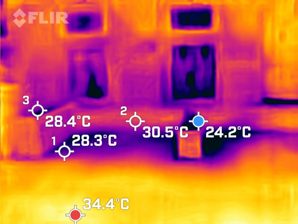
    How does a parklet in the city keep cool?
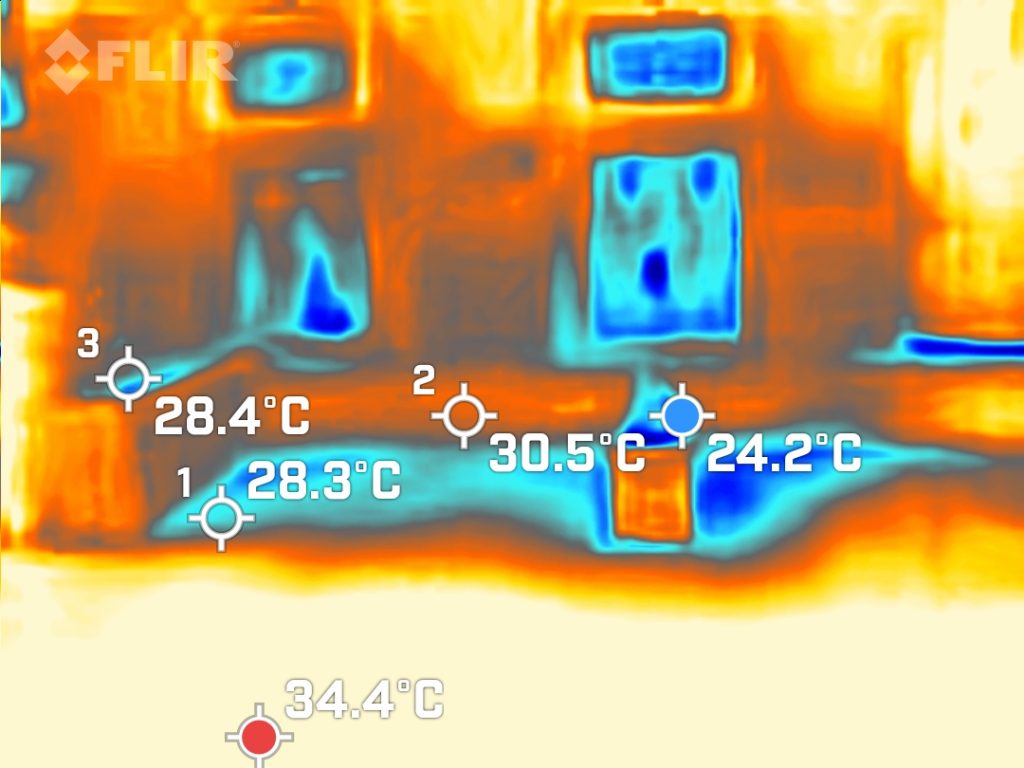
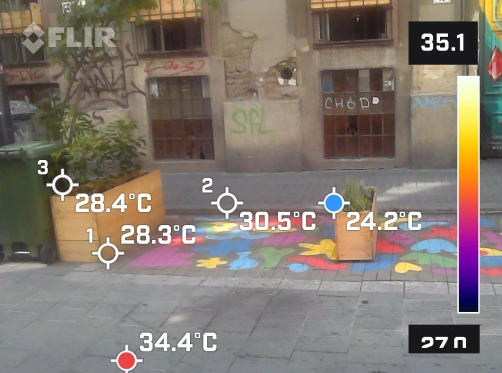
    In Budapest, the summer heat is intense. The images above show how a flower pot or parklet can affect the heat output of surfaces. The images show a pavement decorated with colourful shapes and flower pots, and a bare, stone pavement. The measurements were taken in the shade during a hot and suny day.

    The surrounding stone pavement heated up to 34.4°C, whereas the areas with flower pots and coloured pavement showed cooler temperatures, with 24.2 to 28.4°C measured next to the flower/green pot and 30.5°C measured on the coloured pavement.

    Although a single flower pot or a small patch of coloured pavement will not drastically reduce the overall heat output of a street, they can create slightly cooler zones. Placing several of these facilities in an urban area can make the atmosphere more pleasant and cooler, which improves quality of life for city dwellers.

    These plots also promote natural cooling through evaporation. The use of reflective or light-coloured materials in paving pavements can further enhance the cooling effect, as these materials absorb less heat than traditional dark asphalt.

    Cooling effect of open gates
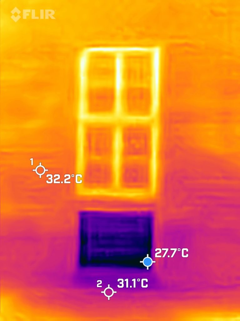
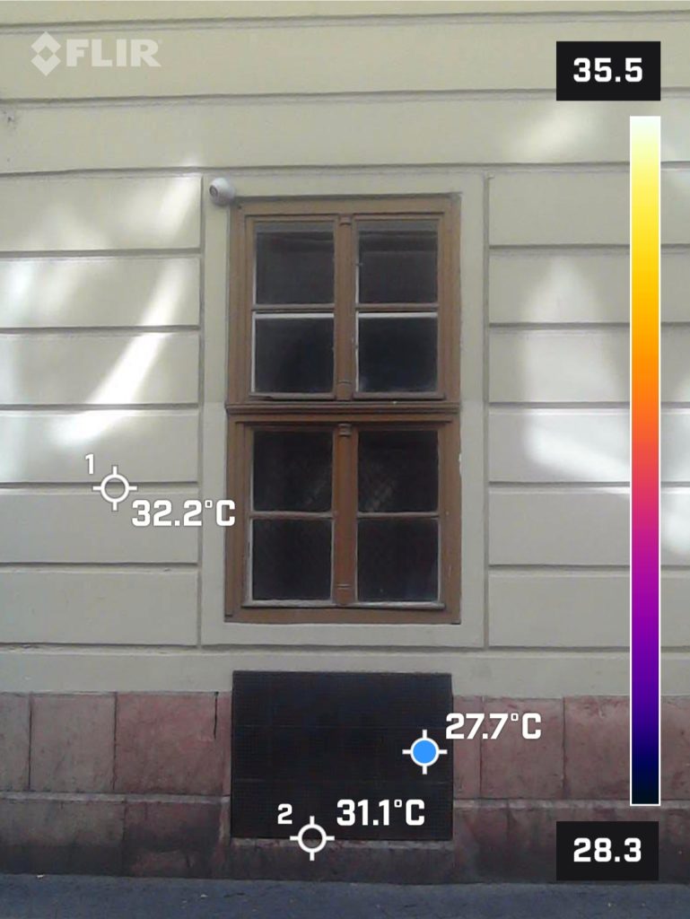
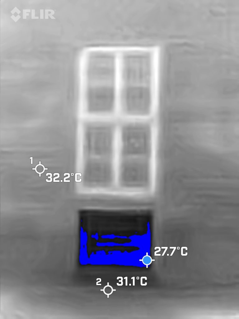
    Natural ventilation can play an important role in reducing the high temperatures at streets. The thermal images above show a phenomenon: cooler air flows out of an open basement and inner courtyard of a block of flats, cooling the surrounding area.

    The thermal camera records the temperature differences between the building and the areas around the open window of a cellar, allowing cooler air to flow out of these spaces and replace the hot air outside. Temperature measurements show that the temperature around the open basement window is only 27.7°C, while the temperature of the surrounding walls exceeds 32.2°C. This cooler air promotes natural ventilation and air circulation at street level, creating a more comfortable microclimate.

    Natural ventilation through open windows/open gates can reduce the urban heat island effect. In addition, the incorporation of green infrastructure such as trees, green roofs and living walls further contributes to cooling by providing shade and promoting evaporative cooling.

    This method can be a particularly important tool in densely built-up urban areas such as Erzsébetváros or Terézváros.

    The effects of watering on heated pavement
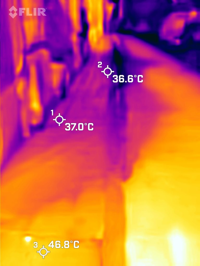
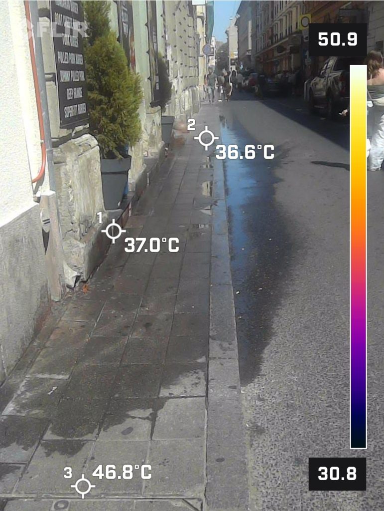
    Pavements can get pretty toasty in the Budapest summer sun. Some residents and businesses use water spray to keep cool. But is this really effective, and is there a better way to do it? We did some thermal imaging measurements in Erzsébetváros during the day on a really hot day.

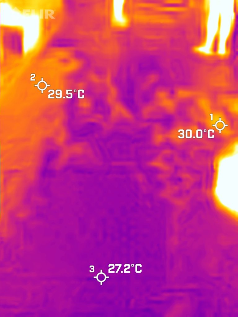
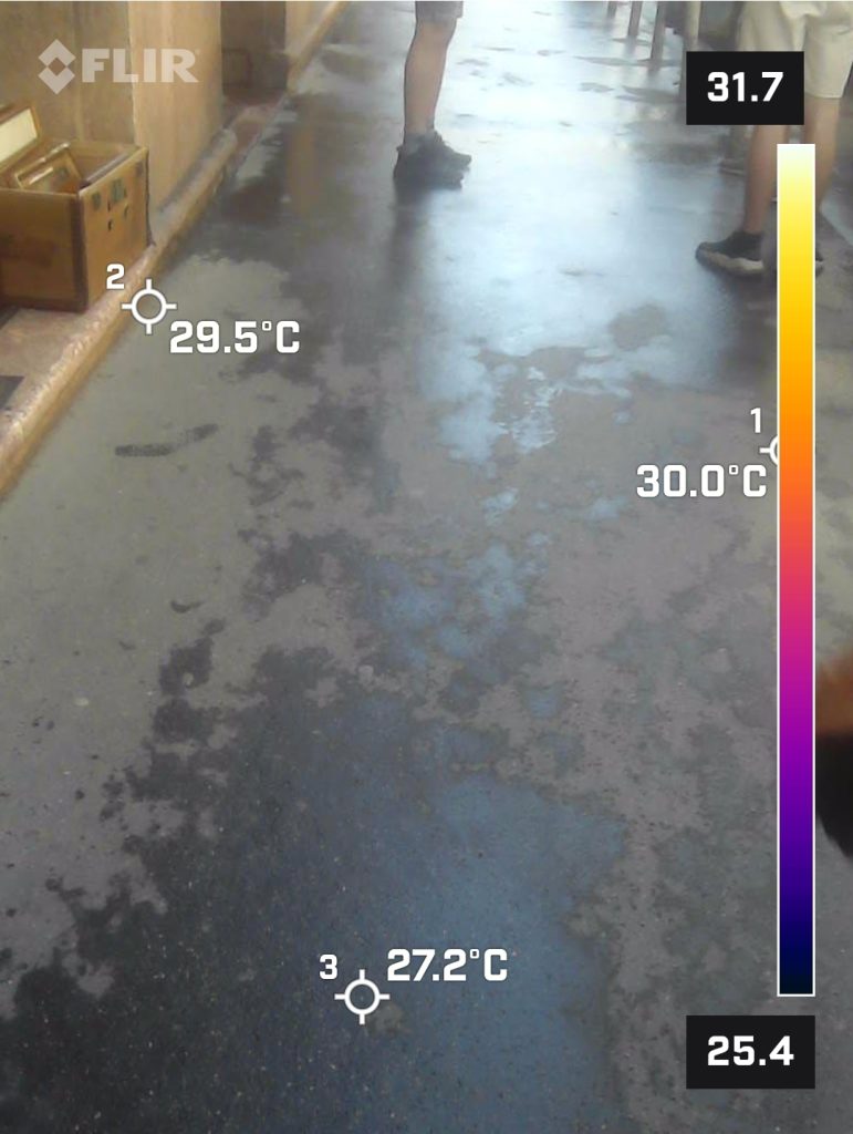
    The images show the temperature of pavements that have been sprinkled and those that haven’t.

    The thermal images revealed that the pavement was significantly cooler after watering. In the areas that weren’t sprayed with water, the pavement temperature ranged from 46.8 °C
    The thermal images show that the watered pavement is about 10 degrees colder.

    After watering, the pavement cools down quickly, but the effect is not permanent. As the water evaporates, the pavement warms up again. So in the long term, this will not solve the problem of an overheated street. Other measures, such as shading or using light-coloured pavements and planting plants, may be more effective.

    The heat of urban benches
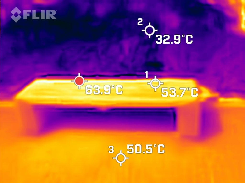
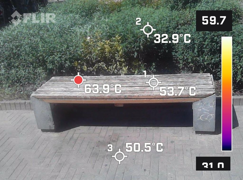
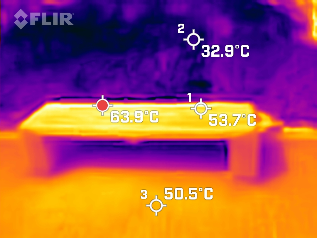
    A bench exposed to direct sunlight has become dangerously hot. Despite being made of wood and surrounded by green vegetation, the thermal camera shows that the surface of the bench can reach temperatures of up to 63.9°C. Even the cooler parts of the bench have warmed up considerably, with readings of 53.7°C and 50.5°C.

    Urban objects such as benches, pavements and building surfaces absorb and radiate heat, contributing to the overall heat stress experienced by city inhabitants. Vehicles, air conditioners and other machinery all emit heat, further increasing urban temperatures.

    During heat waves, the availability of cool and shaded places to rest is essential for the health and comfort of the public. The thermal images highlight a critical aspect of summer urban life: the need for thoughtful planning and design to reduce heat. While benches and other urban furniture are essential to improve well-being, their shading and materials need to be carefully considered to avoid becoming a source of discomfort.

    The heat of parked cars
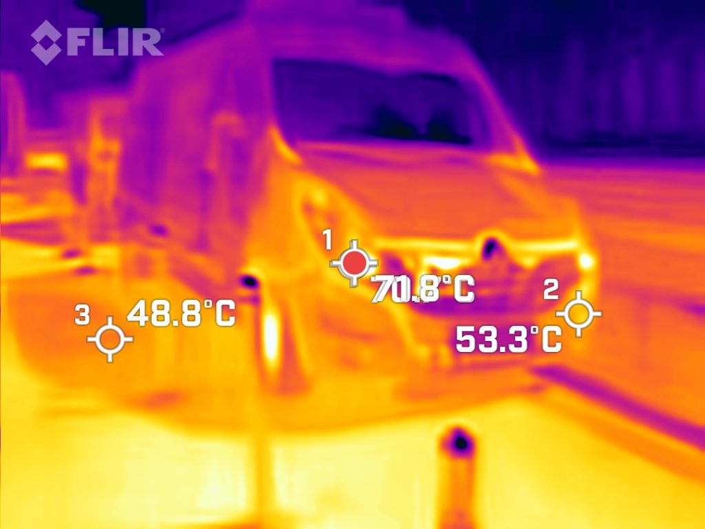
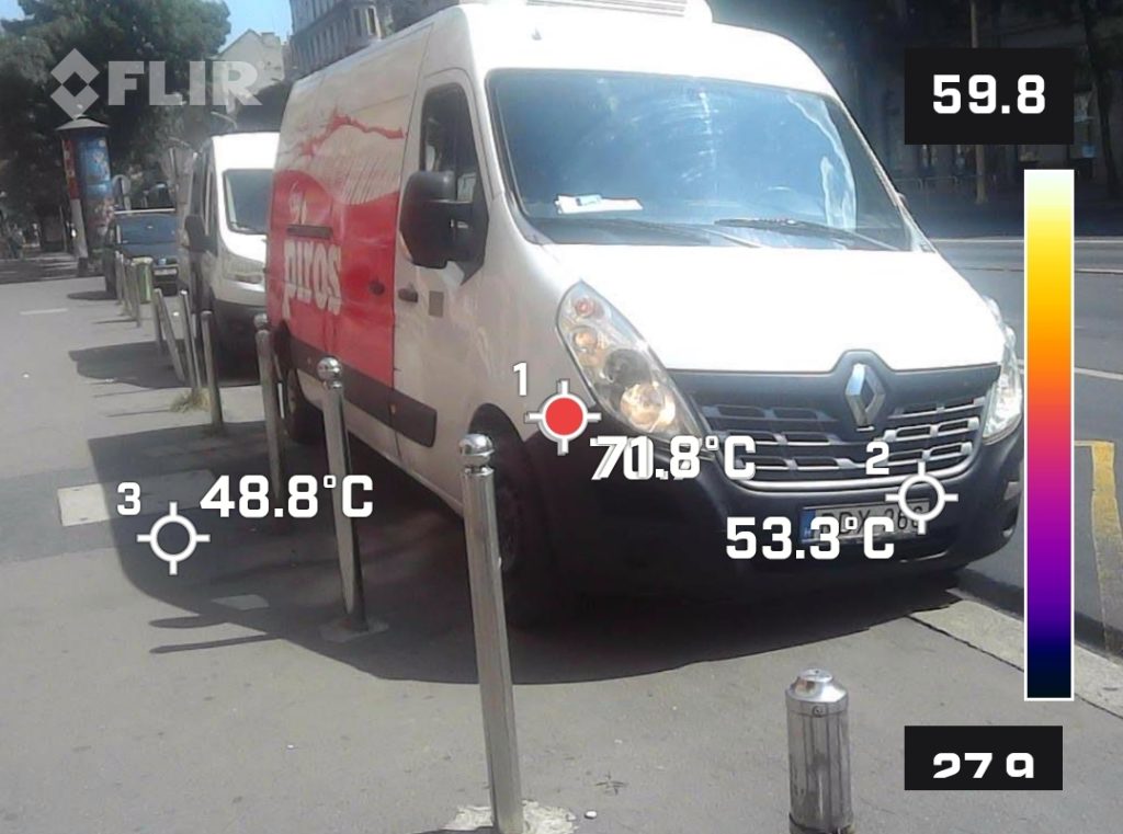
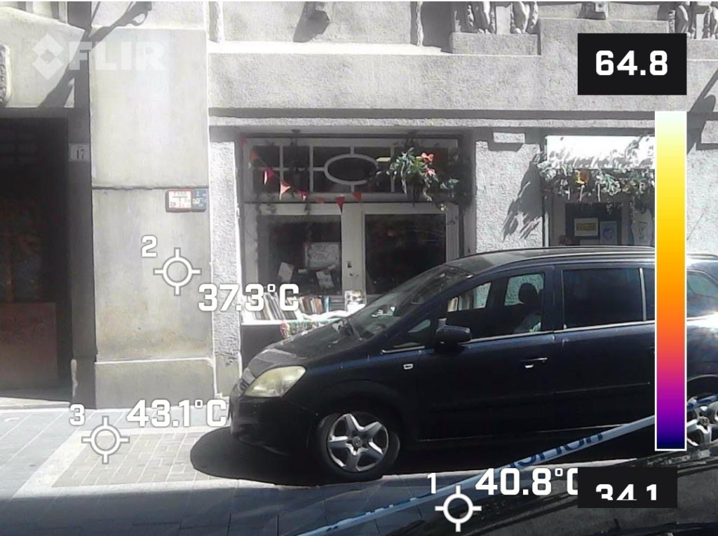
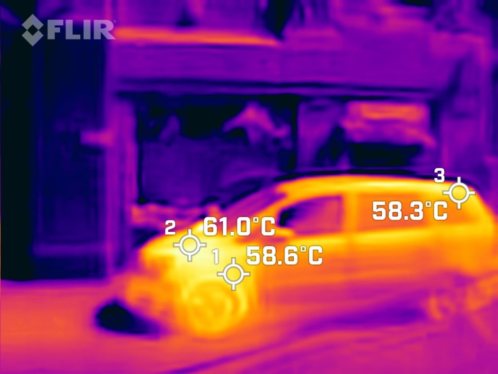
    The thermal images above show an important but often overlooked source of urban heat: parked cars. The thermal camera captured a parked car and truck radiating large amounts of heat onto the pavement. The car’s specific temperature readings show alarming data: the car’s body reaches 61.0°C, while the rest of the car measures 58.6°C and 58.3°C respectively. The body of the van is around 71 degrees Celsius.

    These high temperatures indicate that parked cars become powerful heat sources, significantly affecting the thermal comfort of pedestrians passing by. The problem is exacerbated when cars are parked or when drivers leave their engines running to maintain air conditioning. The latter not only emits more heat, but also contributes to air pollution.

    Designating parking areas away from pavements can reduce direct exposure to vehicle-generated heat. At the same time, it is important to encourage drivers to switch off their engines when parking to reduce unnecessary heat emissions and improve air quality.

    The heat of walls
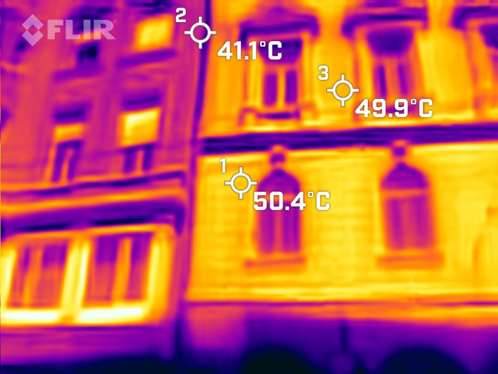
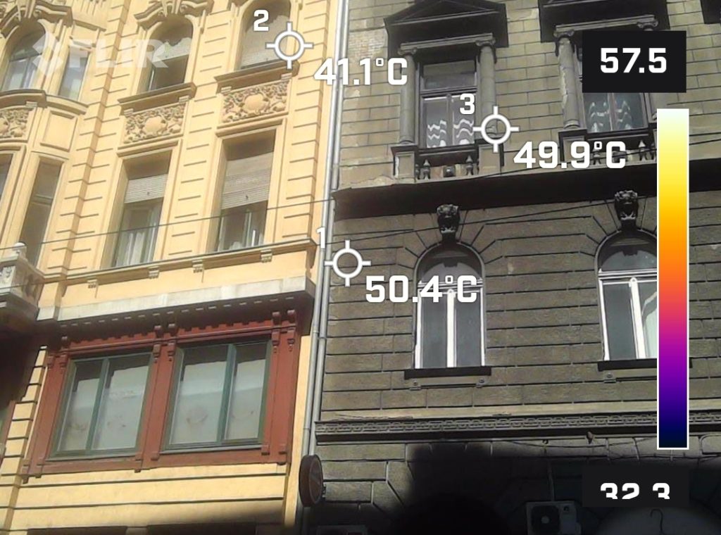
    These images clearly demonstrate the significant impact that exterior wall color can have on a building’s thermal performance. The building on the left, with a lighter-colored facade, exhibits a surface temperature of 41.1°C. In contrast, the building on the right, with a darker facade, reaches much higher temperatures of 50.4°C and 49.9°C. This difference in surface temperature is directly related to the ability of the wall colors to absorb or reflect solar radiation. Lighter colors, like the one on the left building, have a higher solar reflectance and thus absorb less heat from the sun.

    The material and insulation properties of a building’s facade are also crucial factors in determining its thermal performance. Proper insulation can prevent heat from penetrating the building’s interior, reducing the need for air conditioning and improving overall energy efficiency.

    These findings have broader implications for the urban heat island effect, where cities with numerous dark-colored buildings and poor insulation can suffer from significantly higher temperatures compared to surrounding rural areas.

    To mitigate the urban heat island effect and improve building energy efficiency, some key strategies include:

    • Using light-colored, high-reflectance materials for building facades and roofs
    • Incorporating green roofs and walls to increase vegetation and evaporative cooling
    • Improving insulation and air sealing to reduce heat transfer through the building envelope
    • Planting more trees and increasing urban greenery to provide shading and evaporative cooling
  • Taking the city’s temperature from above

    Drones transforming urban thermal mapping

    Satellites are great for spotting regional hot spots, but their resolution is rarely fine enough for street-level action. A quadcopter or multirotor carrying an infrared sensor can fly a few hundred meters above the ground, capture centimeter-scale pixels, and return to your desktop before the asphalt cools off.

    Drone thermal imaging is a key technology for understanding and monitoring the urban heat island effect. It enables the planning and implementation of effective, location-specific interventions. It allows for mapping fine spatial and temporal heat distributions in urban areas.


    Infrared cameras measure heat radiation emitted from surfaces in real time, clearly revealing heat sources such as overheated roofs, pavements and streets that contribute to the heat island effect. The data collected in this way can be used to create detailed heat maps. These maps help to identify critical hotspots, such as overheated buildings or materials, and can inform the planning of urban interventions, such as green roofs, cool roof coatings, and high-albedo pavements.
    Drone thermal imaging is fast, non-invasive and cost-effective as it does not require a built-in sensor network, and it can collect data from hundreds or even thousands of measurement points in a single flight.

    A drone-based thermal mapping (Budapest case study)

    On 14 August 2023 Budapest LL teamed up with the AirScan company to map two adjoining districts in central Budapest.

    • Flights:
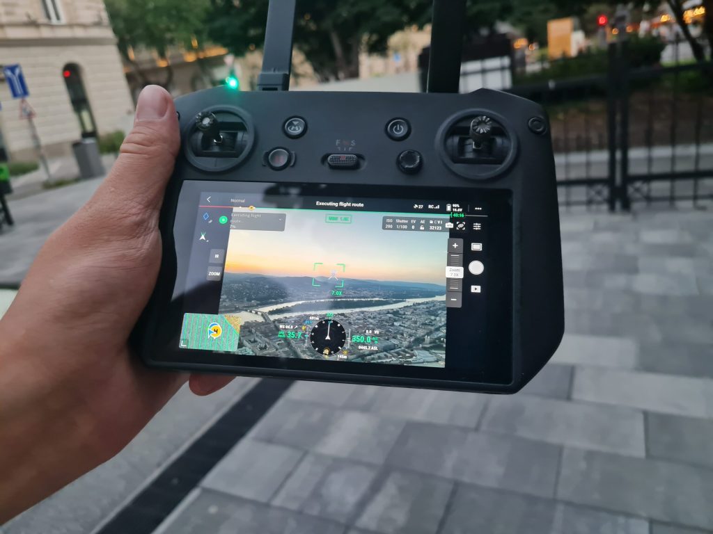
      • In Erzsébetváros: Three back-to-back flights (20:00, 20:45, 21:15) kept below the 22:00 curfew yet captured the full decay phase of the day’s heat load.
      • In Terézváros: Two separate flights (20:09 – 21:41) captured the district in both visible and thermal wavelengths, creating a complete, night-time snapshot of its residual heat.
    • Altitude: 350 m AGL – the sweet spot between wide swath (≈ 46 cm / px in thermal) and legal ceiling.
    • Assets:
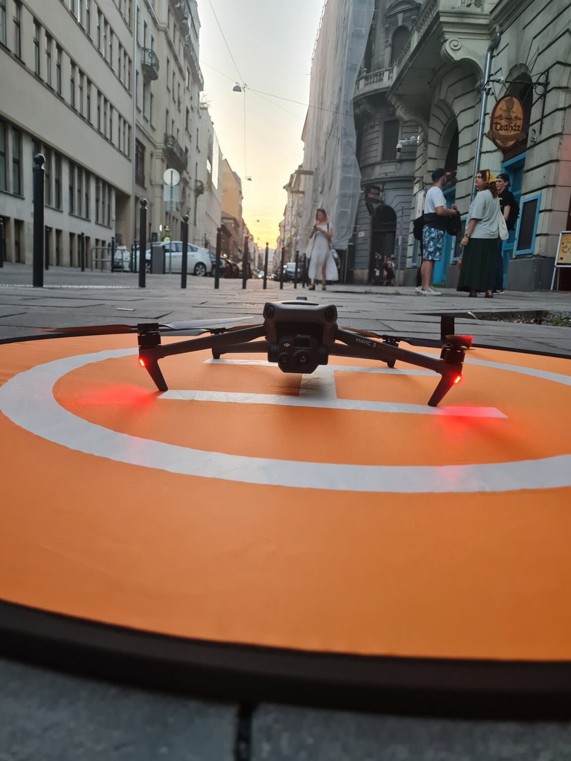
      • Thermal: DJI Mavic 3 Thermal, 640 × 512 px, 46 cm / px ground sampling distance, ±2 °C.
      • Reference RGB: DJI Mavic 2 Pro, 20 MP, 6.8 cm / px.
    • Coverage: The entire administrative boundary of District VI (Terézváros) and VII (Erzsébetváros)

    All 824 radiometric frames from the DJI Mavic 3 Thermal and the companion 434 RGB frames from the Mavic 2 Pro were first radiometrically-corrected and aligned, then stitched in Agisoft/Pix4D into two georeferenced orthomosaics. The thermal mosaic was exported as a 16-bit GeoTIFF (ground-sampling distance ≈ 46.4 cm / px, calibrated –20 °C … +150 °C, accuracy ±2 °C), while the visual mosaic was delivered as a 32-bit RGB GeoTIFF at 7.05 cm / px. Both rasters share the same EPSG-23700 project grid, so they can be stacked without reprojection.

    The orthomosaics for both districts studied are available for public use in the Maps section of the website. Researchers requiring raw sensor data can find this in the APPs section,

    This thermal data can also be used to analyse residential thermal comfort; for example, it can be used to calculate the Human Comfort Index (HCI), which helps us to understand personal heat stress.
    Furthermore, thermal data can be processed using machine learning, visual analytics, and geostatistical
    methods, which reveal spatial patterns in heat distribution and can automatically identify hidden heat bridges or heat source anomalies, for example.

  • Urban Heat Islands

    What is the urban heat island effect (UHI)?

    It describes how temperatures in urban areas are higher than in surrounding rural areas. This difference is particularly significant at night and can result in temperatures that are 2–5°C higher in urban areas.

    What causes urban heat islands?

    The UHI phenomenon is primarily the result of human activities and the characteristics of the built environment. Dark, heat-retaining surfaces, such as asphalt and concrete, absorb solar radiation during the day and radiate the accumulated heat at night, which keeps temperatures consistently high.

    The reduction of green spaces also exacerbates the problem because natural evaporation has a significant cooling effect.

    Traffic, air conditioning, and industrial activities generate continuous heat, further heating the environment.

    Furthermore, dense urban structures—tall buildings and narrow streets—hinder the natural flow of air.

    What problems does this cause?

    This phenomenon is unpleasant and causes serious problems. Higher temperatures increase heat stress, especially among the elderly and people with chronic illnesses. They also increase the number of heat wave-related deaths.

    Warming significantly increases energy consumption, mainly due to cooling needs. This, in turn, increases the environmental burden.

  • Seeing the invisible heat

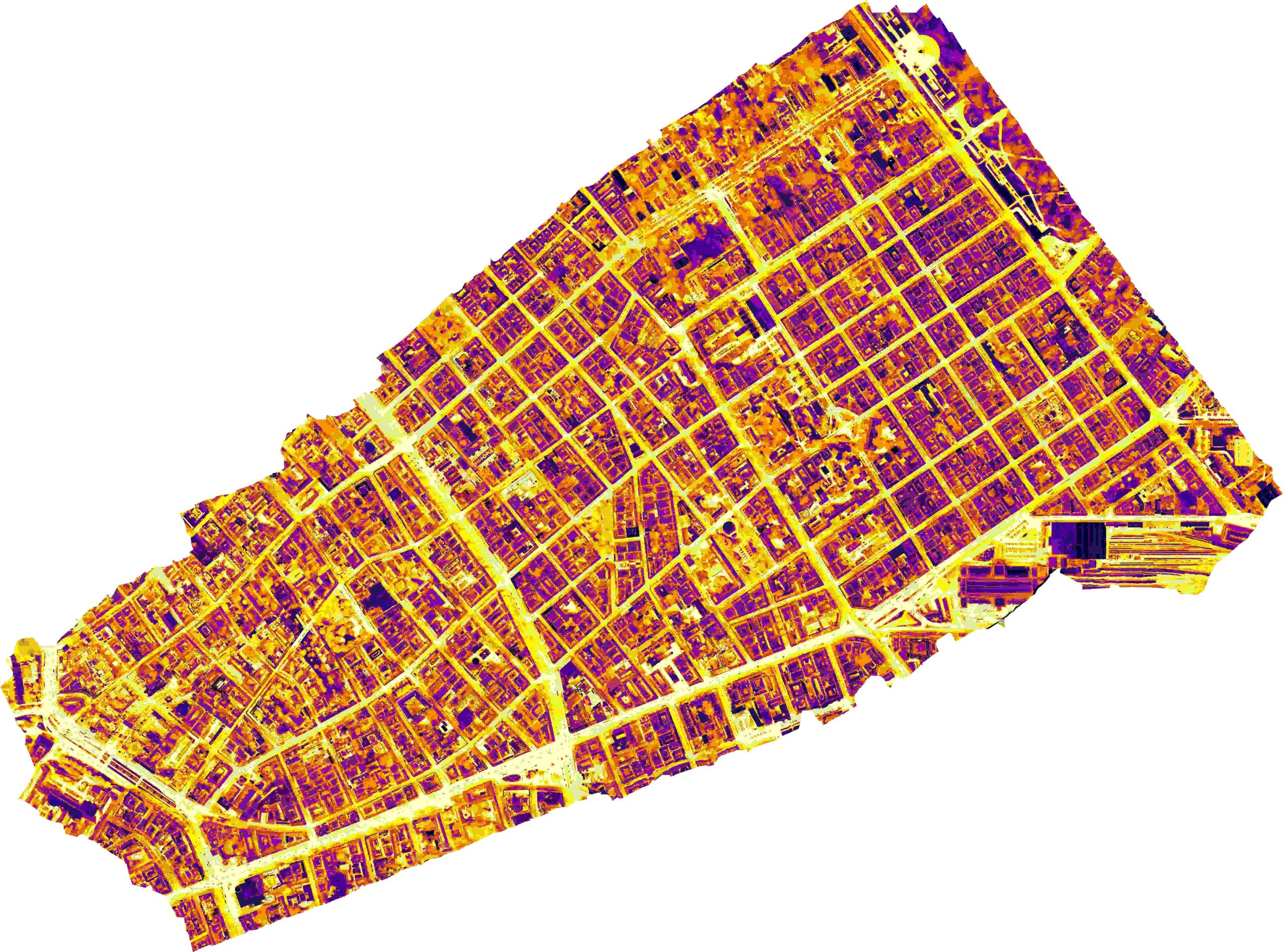
    Budapest city heat map:mapping the hottest spots and cooling options in the city.

    Cities never heat up evenly. Pavements, roofs, tree canopies and courtyards store and release heat at different rates, creating microclimate hotspots that traditional weather gauges cannot detect. High-resolution heat maps reveal this hidden mosaic of heat. They show which roofs require reflective coatings due to being heated by the sun, which asphalt street sections or parking lots need shade, and which leafy areas already act as coolers. In other words, a good heat map transforms the general feeling of ‘summer heat discomfort’ into concrete information that can be used by planners, designers and residents.

    To make this information accessible to all, we have launched an interactive web portal covering the central areas of Terézváros (District VI) and Erzsébetváros (District VII), with plans to expand to other areas soon: https://city.can.hu/osm-orto-heat-layers.html

    What information can you find on the map portal?

    You can navigate between the following map layers:

    • Orthophoto viewing: View high-resolution orthophotos of Terézváros and Erzsébetváros.These provide detailed aerial views of the districts.
    • Thermal Image Viewing: Users can access and explore thermal images covering the entire districts, captured by remote thermal cameras. Thermal images display temperature variations across the landscape.
    • Predicted thermal images:The platform offers predicted thermal images, generated from orthophotos using a CNN model. These predictions provide insights into potential thermal distributions based on the orthophotos.
    • OpenStreetMap Layer: An OpenStreetMap (OSM) layer is available to provide contextual geographical information. Users can overlay the OSM layer with orthophotos and thermal images to enhance navigation and analysis.

    You can switch between layers and easily zoom in on the map. Seamlessly scan from a panoramic view of the area to individual rooftops. You can compare layers, Place the raw heat data collected by drones alongside the ortho photo or the predictions generated by AI to judge the model’s accuracy for yourself. Our open-source Convolutional Neural Network (CNN) model can be used by researchers and other cities. It is available at this link.

    How the map was created?

    We flew DJI Mavic 3 Thermal drones on cloudless summer afternoons in 2023, when roofs and pavements were at their hottest. You can read more about the drone survey here. After calibrating the surface emission factor, the images were stitched together into centimetre-sized orthomosaics with geographic references. At this resolution, even the cooling effect of a single street tree becomes apparent.

    How can you analyse the heat map?
    You can analyse the data visually. You can see the surface temperature by zooming in on the area you’re interested in. Hot surfaces, such as dark roofs and fresh asphalt, appear bright red. Cool zones, including light-coloured roofs, shaded areas and reflective membranes, appear in soothing shades of blue.
    You can download the raw heat map data from this link and use it as a separate layer for your own analysis, provided you comply with the copyright information.
    You can run analysis scripts on the heat maps. One such analysis script can be downloaded from this link.

    Why are these maps important?

    With the help of heat maps, we can now identify specific roofs, streets and playgrounds where urgent action is needed. Community groups use the maps in workshops to demonstrate to neighbours why a patch of asphalt can be so oppressive and how it could be transformed by planting a few trees. As the portal is part of a GIS environment, users can instantly switch between standard and heat maps to provide indisputable evidence.

    For larger-scale projects affecting the city’s infrastructure (e.g. creating pedestrian zones, renovating roofs, or planting new trees), we repeat the drone flights. Side-by-side ‘before and after’ maps provide convincing evidence of what works and help secure funding for the next round of interventions.

    Discover it for yourself!

    The portal is live, and the code and measurement data are publicly available. Budapest’s invisible heat patterns can be explored more effectively and converted into useful knowledge.

  • Combating UHI using CityZcan

    Accurate, on-site data is needed to measure and understand the UHI phenomenon.

    Traditional methods for investigating urban heat islands, such as satellite observations, fixed meteorological stations or mobile measurement tours, typically offer limited spatial and temporal resolution.

    CityZcan bridges these gaps thanks to its portable, compact design and multiple built-in sensors, which enable frequent, flexible and repeated measurements over time. It thus facilitates the transition between transient (simultaneous) and continuous (time series) observations, enabling more accurate mapping of the urban microclimate.

    Sensors


    Flir Lepton 3.5

    The thermal camera records infrared radiation in the 8–14 µm spectral range, providing spatially resolved images of surface temperatures. These images are essential for identifying localised heat accumulation on roads, pavements, and building façades.

    Not only do thermal images enable the identification of heat-absorbing surfaces, they also reveal the thermal dynamics of built structures, thereby supporting climate-conscious urban planning.

    RPi Camera v3

    Albedo values estimated based on reference images taken in the visible range contribute to understanding surface temperature and radiation balance, especially in the case of heterogeneous urban surfaces.

    SPS30

    The SPS30 sensor provides detailed data on particle concentrations. These concentrations are important indicators of air quality and also play a role in atmospheric radiation forcing.

    The interaction of particles with solar radiation, as well as the contribution of particles to the surface area available for condensation, has the potential to influence the distribution of heat within urban areas. This influence can result in alterations to local temperature profiles.

    When employed in conjunction with thermal imaging and a BME680 sensor, the SPS30 can facilitate the discernment of correlations between pollution levels and temperature anomalies, thereby offering insights into the manner in which air quality influences the urban heat island, and, in certain instances, serves to intensify its effects.

    BME680

    The BME680 sensor has been developed to measure ambient temperature, relative humidity, atmospheric pressure and gas concentrations, including VOCs. These factors influence the local thermal environment and human thermal comfort.

    This sensor is of crucial importance, as the perceived air temperature is not solely dependent on the surface temperature. Atmospheric conditions, including humidity and pollutant concentrations, have the capacity to enhance or mitigate the effects of heat stress.

    In urban environments, where the microclimate can vary significantly even over short distances, the integration of these environmental parameters is crucial for understanding and predicting UHI effects.

    Focusing on pedestrians

    Research focusing on pedestrians has revealed that integrating wearable sensor boxes can provide location-specific microclimate data, thereby ensuring the accuracy of environmental impact measurements.

    This approach is particularly valuable in urban areas, where fixed observation systems and vehicle-based survey methods cannot detect the nuances of human heat stress in narrow streets or inner-city parks.

    High temporal resolution in such circumstances facilitates mapping periodic heat phenomena and identifying urban elements or land cover types that contribute disproportionately to the overall heat load.

    Public involvement in combating urban heat islands (UHI)

    A community-based approach enhances the impact of this data by involving citizens in the observation process. When residents are equipped with portable sensor boxes or data collected during community sensing campaigns is shared publicly, city dwellers become active participants in strategies to improve local environmental health and mitigate the urban heat island effect.

    Widespread access to environmental data promotes social awareness and supports community-based initiatives aimed at urban resilience.